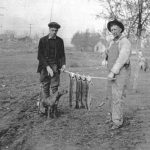
Salmon at Three Mile Dam. Photo courtesy of Umatilla Museum and Historical Foundation
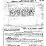
Bureau of Reclamation Land Claim Document, Maxwell Land and Irrigation Company
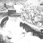
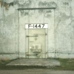
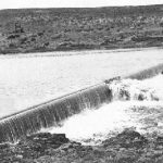
Outlet conduit at Cold Springs Dam, 1912. Courtesy of Hermiston Irrigation District
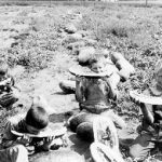
Children eating watermelon in the fields of Irrigon, six miles west of Umatilla. Tons of watermelons were shipped by rail from Irrigon near the turn of the century. Photo courtesy of Bureau of Reclamation
The Old Umatilla was an icon of Columbia River tugboats. Photo courtesy of Army Corps of Engineers
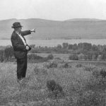
D.C Brownell points to the site of the future McNary Dam. Courtesy of the Umatilla Museum and Historical Foundation
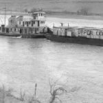
Tug and Barge of the Upper Columbia River Towing Company. In the 1940s a barge tow could carry 1,000 tons up the river. The main cargoes were fuel and wheat. Deepened channels, locks and dams now allow much larger cargos upriver and down. Courtesy of Keith Rodenbough
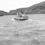
A tug ploughs the rough waters of the upper Columbia in the 1950s. Photo courtesy of Keith Rodenbough
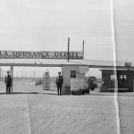
Umatilla Ordnance Depot, circa 1942. Photo courtesy of the Umatilla Depot Outreach Office
Image courtesy of Elmer Dodd Scrapbook, Hermiston Herald
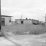
Temporary housing constructed on Hermiston’s newly built Bomb Street. Courtesy of the Umatilla Ordnance Depot Outreach Office
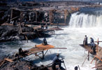
Celilo Falls, fishing grounds for regional Native Americans for at least 10,000 years. The Dalles Dam inundated the site in 1957. Photo courtesy of U.S. Army Corps of Engineers
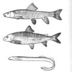
Sucker, whitefish, and lamprey “eel.” Reproduced from Sierra Nevada Natural History, Storer and Usinger, 1963 by permission of the University of California Press
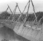
While salmon were a spiritual and nutritional staple, River Peoples of the Columbia made use of a wide range of animal and plant resources, including mammals, deer, rabbit, ground squirrels, and mussels, in addition to fish of several different varieties. Above. Sahaptin fish trap and weir. Photo by Merton L. Miller, 1901. Courtesy of Field Museum of Chicago
Inspecting the remnants of the igloo explosion. Courtesy of Umatilla Depot Outreach Office
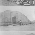
These bunkers, called “igloos,” cover the 25-square mile Umatilla Army Depot. During WWII they housed 2,000 pound “blockbuster” bombs used in aerial bombing. Photos by Donna Sinclair
These bunkers, called “igloos,” cover the 25-square mile Umatilla Army Depot. During WWII they housed 2,000 pound “blockbuster” bombs used in aerial bombing. Photos by Donna Sinclair
These bunkers, called “igloos,” cover the 25-square mile Umatilla Army Depot. During WWII they housed 2,000 pound “blockbuster” bombs used in aerial bombing. Photos by Donna Sinclair
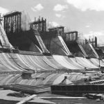
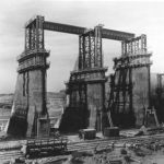
McNary Dam under construction. The dam consists of hydroelectric generators, navigation locks, irrigation facilities, and fish ladders. Construction began in 1947, creating Lake Wallula and extending slackwater navigation for 70 miles up the Columbia and Lower Snake Rivers. The dam covered the old Oregon Trail way-station of Wallula. Eight hundred and sixty homes were moved out of the reach of the pool. Photo courtesy of the Army Corps of Engineers
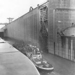
The McNary Dam navigation lock, located on the Washington shore, is 86 feet wide and 670 feet long. Its maximum lift of 92 feet made it the highest single lift lock in the world when completed. Photo courtesy of Army Corps of Engineers
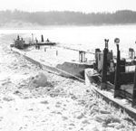
The Columbia River Tug, Winquatt, stuck in ice during the winter of 1947. Courtesy of Keith Rodenbough
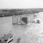
The tank farm at the port of Umatilla is inundated by the Flood of 1948. courtesy of Keith Rodenbough
McNary Dam under construction. Photo courtesy of the Army Corps of Engineers
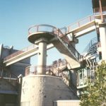
Fish passage facilities at McNary Dam load salmon onto barges and truck them below Bonneville Dam for release. Photo by Donna Sinclair
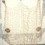
Net hanging on wall at McNary Dam’s Visitor’s Center. Many different fishing methods were used by Native Americans in the lakes, rivers and streams near the Umatilla Rapids. Stone weights like these were used to hold nets under water. Photo by Donna Sinclair
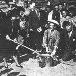
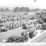
Mrs. McNary turns the first shovelful of earth for McNary Dam. The day of merry-making is now recalled fondly in an exhibit where the still-shiny bucket and shovel sit at the McNary Dam Visitor’s Center. Courtesy of East Oregonian
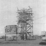
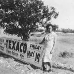
This cowboy is still an icon on the main street of Umatilla.
A Texaco station opens for business in boomtown Umatilla. Both images circa 1947-1950. Courtesy of the Umatilla Museum and Historical Foundation
Fine “flour gold,” reclaimed during sand and gravel mixing from the bed of the Columbia, was placed in souvenirs such as the above. C. E. Goody of Tacoma, WA, ran the gold operation, and 10 % of all gold found during construction went to J.G. Shotwell of Hermiston who produced the sand and gravel mix; another 10% went to the government. Courtesy of Army Corps of Engineers
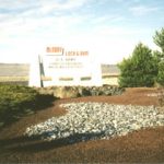
This motel welcome sign, reflecting Umatilla’s growth during McNary Dam Days, hangs on the wall of the Umatilla Museum and Historical Foundation.
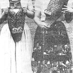
Gloria Lampkin, left, and Ernabel Mittelsdorf, right, look over imitation owls intended to scare away pigeons in 1959. The two women worked together at the dam for over forty years. Photo courtesy of Spokane Review, June, 1959
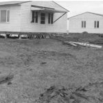
McNary Townsite, “home town” for the Army Corps of Engineers, hundreds of administrative employees, and some contractors – under construction two miles east of Umatilla. These homes were shipped by barge from wartime housing in Vancouver, Washington, and placed on pedestal-type foundations. The buildings, purchased from the federal housing administration, were transformed to “freshly painted, newly insulated, modern day” dwellings. Notice the Columbia River in the background. Courtesy of Army Corps of Engineers
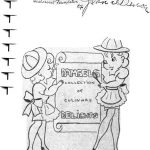
Front cover of the Co-En-Da cookbook. Click on image to view selections and drawings, including “How to Cook a Husband.” Courtesy of Umatilla Museum and Historical Foundation
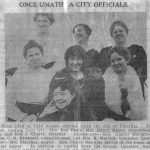
Umatilla city officials. Image courtesy of Umatilla Museum and Historical Foundation
Crowds gather to witness the dedication of McNary Dam on September 23, 1954. Courtesy of Army Corps of Engineers
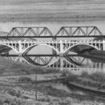
This small bridge built in the 1930s spans the Umatilla River at its confluence with the Columbia. Photo courtesy of the Umatilla Museum and Historical Foundation
Entrance to McNary Dam. The Umatilla Bridge to Paterson now connects eastern Oregon and Washington in the distance on the left. Photo by Donna Sinclair, 1999
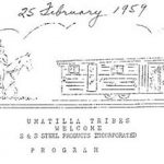
A flyer announcing the arrival of S & S Steel at McNary Townsite.
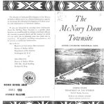
The Bureau of Indian Affairs Document promoting industrial development at McNary Townsite.
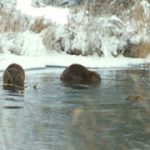
Above. Beavers near the McNary Dam nature trail, 1993. Photo courtesy of Roy and Evie Gunsolley
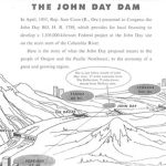
Cover of promotional pamphlet produced by the Army Corps of Engineers for John Day Dam
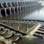
John Day fish Ladders. Courtesy of Portland District Army Corps of Engineers
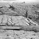
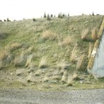
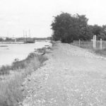
The dike west of 3rd street on the river in Umatilla should have been covered by water from John Day. Courtesy of the Umatilla Museum and Historical Foundation
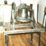
Once the lower half of the town was transferred to the Corps of Engineers, this bell from the old Umatilla school house became federal property. When the Corps denied community members the bell’s retrieval four or five men snuck into the schoolbuilding one night and took it. It now sits in the Umatilla Museum and Historical Foundation as a reminder of lost historic buildings. Photo by Donna Sinclair
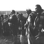
Native religious leaders from around the region attend the ceremony at Mission, Oregon.
Native religious leaders from around the region attend the ceremony at Mission, Oregon.
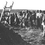
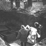
The six wooden boxes filled with artifacts and remains are buried in a common grave.
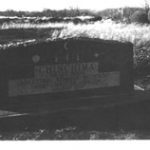
The marker reads “Chinchinma, The Old People. Ancestral Remains Relocated From Umatilla, Oregon, Reburied 1976.” Photos courtesy of Army Corps of Engineers
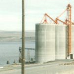
These grain elevators in Umatilla replaced elevators removed for the John Day inundation. As the Columbia turned into a series of slackwater lakes through dam building, agricultural development expanded. The amount of exported wheat increased annually. Larger barges can now hold an average of 3,000 tons of wheat or 875,000 gallons of gasoline for export. Refrigerated barges, with their own electric generators, carry massive amounts of frozen potato products for MacDonalds Corporation as far away as Saipan. Photo by Donna Sinclair
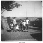
Jose Rodriguez and children.
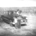
Maria Rodriguez and family. The Rodriguez family came to the Hermiston area in 1956 to work in the hop fields. Jose came to the United States with his father as an infant, just after the Mexican Revolution. Maria was born in Texas.
The Umatilla River and fish house, facing east.
Margaret D’Estrella lived on this property as a child. Note the flood irrigation system in the field and grain towers in the distance.
Wal-Mart
The $1.2 billion Umatilla Chemical Incineration plant under construction, April, 1999. The plant is located next to K-block where 2,635 containers holding one ton each of mustard blister agents, and more than 155,000 rocket-bombs and projectiles filled with nerve agent VX are stored.
The CSEPP program set up this Emergency Preparedness display in the Hermiston Public Library in 1999. Photos by Donna Sinclair
Umatilla schoolchildren created this April, 1999 McNary Dam display. Since the advent of fishwheels, gillnets, and dams, annual runs of Snake River Chinook have dwindled from 1.5 million fish in the late 1800s to 125,000 in the 1950s, to only 2 in 1989. Photos by Donna Sinclair
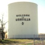
Umatilla, Oregon water tower near the intersections of Highway 730 and I-82. Photo by Donna Sinclair
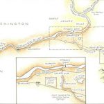
Map by Evelyn Hicks
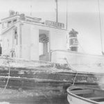
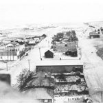
Umatilla, 1905. Photo courtesy of the Umatilla Museum and Historical Foundation
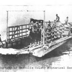
Jehu Switzler started a horse-powered Switzler Ferry in 1879 and the Switzler family ran a ferry across the Columbia until the Wallula Cutoff Road opened in 1935. In 1948, ferry runs started again, transporting dam workers until a bridge from Umatilla to Plymouth opened in 1955. Photo courtesy of the Umatilla County Historical Society
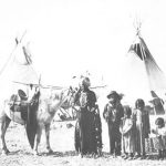
The Umatilla, Niktoway (Columbia Joe), and Family, July 4, 1901. According to Thomas Morning Owl, a descendant of Niktoway, “. . . because he lived on the Columbia River and he was an Indian, rather than calling him Indian Joe, they called him Columbia Joe.” Photo by Dr. Edward H. Latham, Courtesy of Thomas Morning Owl
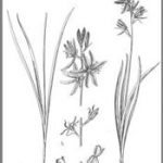
Camas, gathered with hardwood digging sticks, were available by April. Indian women baked the roots in stone-lined earth ovens along with an edible black lichen, or made mush by stone-boiling the roots in baskets.
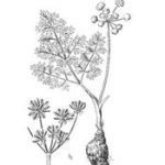
Couse (or “biscuitroot”) gathered with hardwood digging sticks, were available by April. Indian women baked the roots in stone-lined earth ovens along with an edible black lichen, or made mush by stone-boiling the roots in baskets. Left, Camas. Below, Couse. Courtesy of University of Washington Press
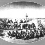
Walla Walla Council. Gustavus Sohon drawing. By permission of Special Collections,Washington State Historical Society.
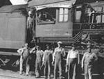
Workers on the Union Pacific Railroad. Courtesy of Umatilla Museum and Historical Foundation .
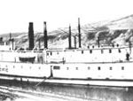
A Union Pacific steamboat plies the Columbia circa 1880s. Courtesy of Umatilla County Historical Society
Three Mile Diversion Dam near Irrigon on the Umatilla, circa 1905. Courtesy of the Umatilla Museum and Historical Foundation
Promoting the study of Columbia River Basin history