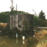
This pump station on Elrod Drive was installed on a secondary slough by the Port of Portland, and operated as part of the emergency backup system until decommissioned in 2000. Photo by Donna Sinclair 2000
Blue Herons fly above the Columbia River Slough. Photo courtesy of Don Baccus
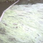
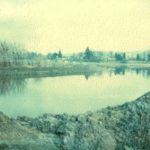
Image of the flood.
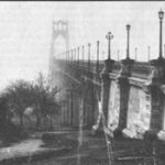
Bridge across the Willamette in 1931.
A Chinook canoe. The sail, introduced by white traders, had been adapted for use by the time George Gibbs made this drawing in 1850. Courtesy of Smithsonian Office of Anthropology, Bureau of American Ethnology Collection
The British Hudson’s Bay Company sited Fort Vancouver at what became Vancouver, Washington on the Columbia floodplain for navigational and trade purposes. In 1849, the U.S. Army established Vancouver Barracks, laying claim to the region for the U.S. Notice Vancouver’s Officers Row, circa 1855, on the hillside. Courtesy of the National Park Service
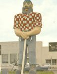
Paul Bunyan postcard, circa 1950s, reads on back, “Constructed through contributions by Kenton District businessmen, Paul Bunyan, symbolic of Oregon’s lumber industry, salutes Oregon visitors from near and afar.” The postcard was available for a nickel from a slot near the park bench on on the left side of photo. Courtesy of Victor Nelson
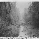
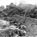
In some areas the Columbia Slough was a “meandering, marshy stream.” But by 1917, much of the Lower Slough was already degraded by sewage and industrial sludge. Courtesy of Multnomah Drainage District
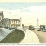
1915 postcard reads on back, “This new bridge spanning the Columbia River, connecting Portland, Oregon, and Vancouver, Washington is now being constructed. The very latest type of bridges, which is the greatest of bridge engineering at this time is one of the interesting features of the new Pacific Highway.” Courtesy of John Burpee
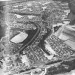
Aerial view of Vanport City. Courtesy of the U.S. Army Corps of Engineers
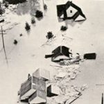
Vanport houses were never meant to be permanent. Constructed on wooden foundations, they floated “like corks” during the flood. Courtesy of Bonneville Power Administration
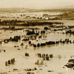
The Columbia floodplain under water, May 1948. Courtesy of Bonneville Power Administration
Many who lived on the managed floodplains became angry with a government that promised them protection. The 1948 flood extended from British Columbia to the Pacific Ocean, and the Vanport disaster became the symbol for future flood control on the Columbia. River communities experience over $100 million in property damage and lost 51 lives in the flood. Courtesy of Multnomah Drainage District
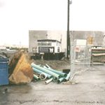
This sewer drains into the headwaters of the Columbia Slough at Fairview Lake where pollution and development have increased rapidly in the past 20 years. Photo by Donna Sinclair
The inside of a Chinookan house displays artwork reflecting a complex society. Watercolor by Paul Kane. Courtesy of Stark Foundation
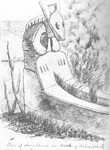
A Chinookan burial canoe, drawn by George Gibbs in 1850. Courtesy of the Smithsonian
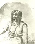
Paul Kane watercolor titled “A Cascade Indian.”Courtesy of the Stark Museum of Art, Orange, Texas
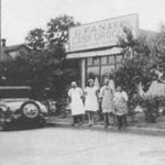
American immigrant Theophanes Frankis (Gus) owned this local grocery store on Willamette Boulevard and Catlin Avenue. The store catered to neighborhood customers of many nationalites. Left to right, Gus Fanakis, Helen Miles, Mike and Maurice Finn. Courtesy of Helen Miles
Front page of the June 11, 1948 Northwest Clarion Flood Special.
Flood evacuees at Trinity Episcopal Church in 1948. This image demonstrates that although the Oregonian declared “No Color Line Here” during and after Vanport days, at least some segregation efforts continued during evacuation. Courtesy of the Oregon Historical Society
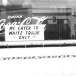
This restaurant stood directly across the road from the Kenton Theater. Similar signs sprouted all over Portland during the war as the African American population increased. After the Vanport Flood, the Portland Realty Board’s “Red line” squeezed African Americans into north Portland. City statistics still reflect disproportionate numbers of African Americans in many neighborhoods. Courtesy of the Oregon Historical Society
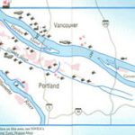
The Toxic Waters map highlights major and minor industrial discharges, and other toxic sites as identified by Northwest Environmental Advocates. Click here to view larger version of the map, with a key. Courtesy of Northwest Environmental Advocates
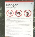
The city of Portland replaced signs posted by Northwest Environmental Advocates and the Black United Front with these multilingual signs.
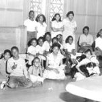
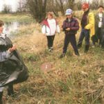
George Middle School students study the ecology of the Columbia Slough. Their experiences on the slough helped them to better understand the connections between themselves, their families, and the environment. See Ranger Rick article below for the full story. Photo Courtesy of David Falconer
A 1990s housing development built on dredge spoils of the re-shaped lake. A small core sample taken from Fairview Lake in the early 1990s indicated heavy contamination in the lake. Photo by Donna Sinclair
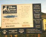
Blue Heron Shores Residential Development on the upper slough at Fairview Lake. Photos by Donna Sinclair, 2000
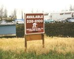
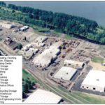
Industrial sites for sale on a branch of the lower slough near the Multnomah County Drainage District.
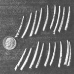
“Hiqua” or dentalium was obtained from Vancouver Island, then strung in fathoms that determined their value. These dentalia number eighty to the fathom, whereas the standard, high value dentalia numbered forty to the fathom. Photo by Norma Lee Kayler. Courtesy of Dr. Robert H. Ruby
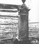
The gravestone of Captain Lewis Love is located at the northern boundary of the Columbia Cemetery where his donation land claim stood. Courtesy of Kenton Neighborhood Association
This advertisement in The Peninsula, a boosterish publication, sought to draw people to the budding Portland peninsula. The Oregon Flake Food Company, St. Johns Port, a shipyard, a machine works, and woolen mills were but a few of the early industries. Although incorporated into the city of Portland for over a hundred years, residents of St. Johns still harbor a local identity manifested in support for local businesses.
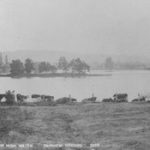
An image of a small boat passing “Portland Union Stock Yards”
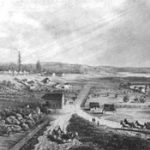
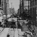
Image of old downtown Kenton.
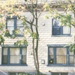
These renovated rowhouses on Denver Avenue once housed workers from the Swift Meatpacking Company. Today they are apartments. Photo by Donna Sinclair
Kenton Sewer – the Columbia Slough, 1934. Photo courtesy of the City of Portland Stanley Parr Archives and Records Center
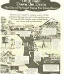
Image of a postcard titled “Only Rain Down the Drain”
Image of a postcard titled “Rain, sewers and flooded basements”
The Port of Portland sponsored WPA Project 975 to build the Portland International Airport in 1936. Photo courtesy of the Oregon Historical Society
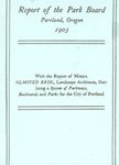
Olmsted Brothers, Report of the Park Board, 1903
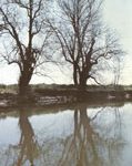
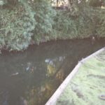
Image of two trees aside a river.
the old Union Pacific Stockyard Building, torn down in 1998 to make way for industrial development and concrete strip malls on Marine Drive. Photos by Donna Sinclair, 1998
the old Union Pacific Stockyard Building, torn down in 1998 to make way for industrial development and concrete strip malls on Marine Drive. Photos by Donna Sinclair, 1998
Heron Lakes Golf Course. Right, Portland International Raceway. This marshy landscape once housed Vanport City, the nation’s largest World War II public housing project, destroyed by a flood on May 30, 1948. Photos by Donna Sinclair, 1998
Heron Lakes Golf Course. Right, Portland International Raceway. This marshy landscape once housed Vanport City, the nation’s largest World War II public housing project, destroyed by a flood on May 30, 1948. Photos by Donna Sinclair, 1998
The Riverside Golf and Country Club in a residential/commercial neighborhood near Multnomah Drainage District Number One. Photos by Donna Sinclair, 2000
The Riverside Golf and Country Club in a residential/commercial neighborhood near Multnomah Drainage District Number One. Photos by Donna Sinclair, 2000
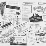
This slough flyer highlights the many activities of the Columbia Slough Watershed Council. Courtesy of the Bureau of Environmental Services
Ariel view of the slough.
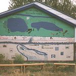
This sign at Whitaker Ponds welcomes students to education about the Columbia Slough. Since its 1995 purchase by BES and Metro, Whitaker Ponds, previously an unofficial garbage dump, has become a center of learning activity about the Columbia Slough Watershed, a system of lakes and sloughs stretching over sixty miles. Photo by Geoff Wetherell, Summer 2000
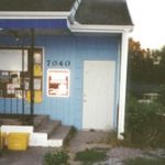
Home of the Columbia Slough Watershed Council where one staff member and an Americorps volunteer coordinate efforts to clean up and revitalize the Columbia Slough Watershed. Photo by George Winston Weatheroy, Summer 2000
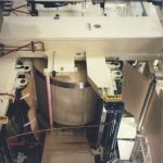
This experimental holding pond at Whitaker Ponds is part of innovative efforts to revitalize the Columbia Slough watershed. Stormwater discharge, oil, and runoff from the industrialized Columbia Boulevard drains through pipes into an underground tank where sludge collects. It then seeps into the rocks in the foreground of this image, further diluting pollutants, before reaching the bioswale above, and ultimately Whitaker Ponds. The pond, once one of a large system of lakes and sloughs on the Columbia’s floodplain is slowly returning to a more natural and usable state for both humans and wildlife. Photo by Geoff Wetherell, Columbia Slough Capstone student, Summer 2000
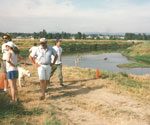
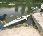
The Columbia Slough Small Craft Regatta, begun through the action of neighborhood activists like Kenton’s David Myers Eatwell in partnership with BES and the Columbia Slough Watershed Council, is an annual event to educate the community and demonstrate the slough’s potential as a recreational oasis within the city. Photos courtesy of the Kenton Action Plan
The Columbia Slough Small Craft Regatta, begun through the action of neighborhood activists like Kenton’s David Myers Eatwell in partnership with BES and the Columbia Slough Watershed Council, is an annual event to educate the community and demonstrate the slough’s potential as a recreational oasis within the city. Photos courtesy of the Kenton Action Plan
The Columbia Slough Small Craft Regatta, begun through the action of neighborhood activists like Kenton’s David Myers Eatwell in partnership with BES and the Columbia Slough Watershed Council, is an annual event to educate the community and demonstrate the slough’s potential as a recreational oasis within the city. Photos courtesy of the Kenton Action Plan
Forty Mile Loop Brochure, city of Portland
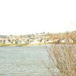
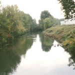
Columbia Slough near 33rd. Photo by Donna Sinclair, 2000
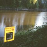
Sewage warning sign near Denver Avenue and Schmeer Road. Photo by George Winston Weatheroy, Summer 2000
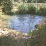
Ducks swim in the slough at N.E. 33rd, north of Columbia Boulevard. Photo by George Winston Weatheroy, Summer 2000
An otter swims in the Columbia Slough off of N.E. 33rd, north of Columbia Boulevard. Photo by George Winston Weatheroy, Summer 2000
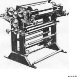
Printing Press at Kenton Machine Works in the 1930s. Courtesy of Victor Nelson
Printing Press at Kenton Machine Works in the 1990s. Courtesy of Victor Nelson
Columbia Slough near the Portland Airport, circa 1940s. Courtesy of the Multnomah Drainage District
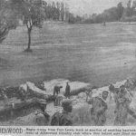
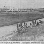
African American troops were segregated from white troops until after the Korean War. These men from Fort Lewis assisted in sandbagging near the Alderwood Country Club during the 1948 flood. Courtesy of the Multnomah Drainage District
African American troops from Fort Lewis work near the Portland Airport during the 1948 flood. Courtesy of the Multnomah Drainage District
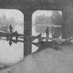
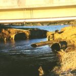
Fishing under the Denver overpass after the dike broke in 1948. Courtesy of the Multnomah Drainage District
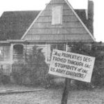
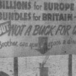
Post Vanport Flood efforts to attain emergency funds. Courtesy of the Multnomah Drainage District
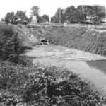
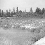
Dredging at Fairview Lake circa 1960s. Courtesy of the Multnomah Drainage District
Dredging at Fairview Lake circa 1960s. Courtesy of the Multnomah Drainage District
The headwaters of the Columbia Slough at Fairview Lake, 2000. Photo by Donna Sinclair
New development on the dredge spoils at Fairview Lake, 2000. Photo by Donna Sinclair
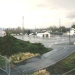
The older residential side of Fairview Lake, 2000. Photo by Donna Sinclair
Promoting the study of Columbia River Basin history