Drawing from Charles Wilkes, Narrative of the United States Exploring Expedition During the Years 1838,1840,1841,1842
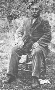
William Hartless. Courtesy of the Smithsonian Office of Anthropology, Bureau of Ethnology Collection
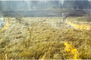
Fire continues to shape the valley though less thoroughly than in years past. Here a ranger uses a controlled burn to rid the Dorena dam area of weeds. Courtesy of the U.S. Army Corps of Engineers
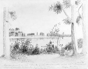
A drawing of the Willamette Valley by Henry Eld of the Wilkes expedition, 1841. Courtesy of the Beinecke Rare Book and Manuscript Library, Yale University
From Kalapuy Texts, Melville Jacobs, 1945
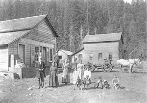
The Sutherland family in front of their store, probably in London, south of Cottage Grove, 1898. Courtesy of Lane County Museum
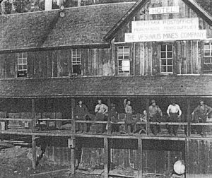
Vesuvius Mine, 1914. Merle S. Moore collection. Courtesy of the Lane County Museum
Merle Snodgrass Moore National Guard, 1917-1918. Photo courtesy of Lane County Museum
Downtown Cottage Grove, 1927. Courtesy of the Cottage Grove Museum
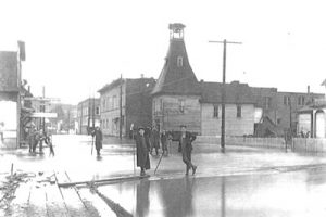
Downtown Cottage Grove, 1909. Courtesy of Lane County Musuem
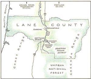
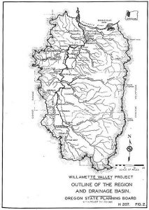
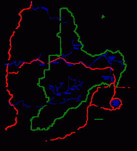
Willamette Valley Project Map
The Willamette Valley Flood Control Commission inspecting a site in 1948. Courtesy of the U.S. Army Corps of Engineers
Tulip farm in the Willamette Valley with Mt. Hood in the background. Courtesy of the Oregon Tourism Commission and the Department of Agriculture
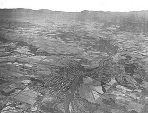
Aerial view of the Willamette Valley near Corvallis. Courtesy of the U.S. Army Corps of Engineers
Downstream view of the Cottage Grove Dam spillway. Courtesy of the U.S. Army Corps of Engineers
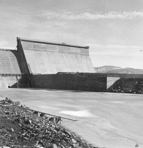
Finished spillway at Cottage Grove Dam. Many publicity shots of dams show water flowing over the spillway, an event that dam operators avoid otherwise. Courtesy of the U.S. Army Corps of Engineers
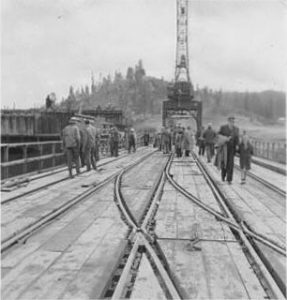
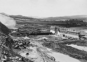
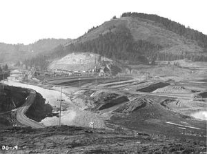
Construction of Dorena Dam. Courtesy of the U.S. Army Corps of Engineers
A completed Dorena Dam. Courtesy of the U.S. Army Corps of Engineers
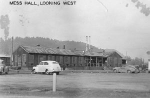
While the Corps removed some buildings to make way for the dam and reservoir, they built others to accomodate workers. This photo shows the mess hall constructed at Dorena, 12 March 1948. Courtesy of the Army Corps of Engineers
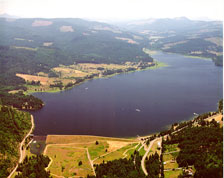
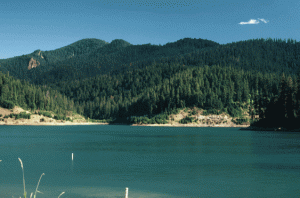
Cottage Grove Reservoir. Cottage Grove Reservoir. Courtesy of the U.S. Army Corps of Engineers
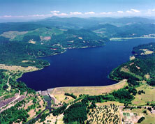
Dorena Reservoir. Cottage Grove Reservoir. Courtesy of the U.S. Army Corps of Engineers
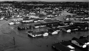
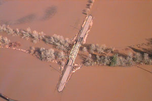
Keizer, just north of Salem during the flood of 1964. Courtesy of Marion County Emergency Management
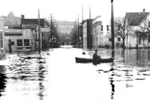
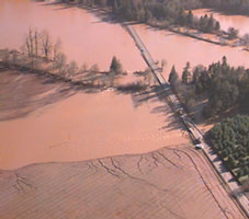
The Willamete Valley during the flood of 1996. Courtesy of Marion County Emergency Management
The Willamete Valley during the flood of 1996. Courtesy of Marion County Emergency Management
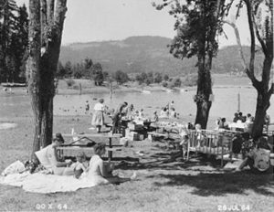
Picnickers at Dorena Lake, 1964. Courtesy of the U.S. Army Corps of Engineers
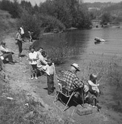
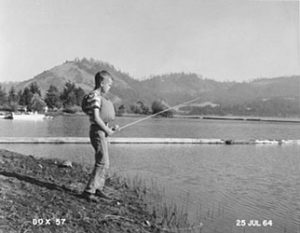
Fishing at Cottage Grove and Dorena Lakes. Courtesy of the U.S. Army Corps of Engineers
Fishing at Cottage Grove and Dorena Lakes. Courtesy of the U.S. Army Corps of Engineers
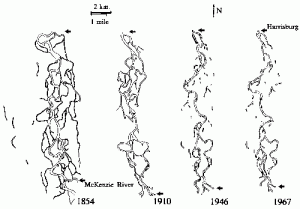
The braided course of the Willamette has diminished over time with deveopment and increasing human population in the valley. Courtesy Willamette Riverkeepers
In 1938 Portland Mayor Joe Carson (center) joined 4,000 school-aged children as they rallied for clean rivers. Courtesy of the Oregon Historical Society, Negative Number cn001253.
Tom McCall lead efforts to clean the Willamette River as both a reporter and a politcian. Courtesy of the Oregon State Archives
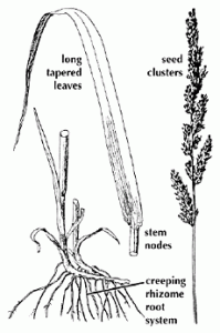
Canary Reed Grass is one of the dominant species at Cottage Grove and Dorena lakes. An invader, this highly competitive grass threatens the integerity of native wetland areas. Courtesy of the King County Department of Natural Resources
Part Two
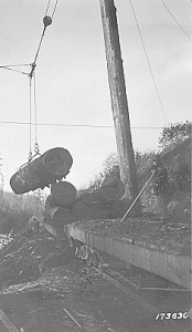
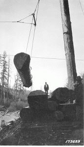
Steam jammers moved logs onto rail cars. In this photo lumber is being loaded from a pond at Rujada, Oregon, March 24, 1923. Courtesy of Umpqua National Forest.
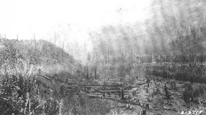
This photograph taken in 1902 shows an inland cut near the Bohemia Ranger District. Once railroads were laid, waterways became a less prominent though still important mode of transportion in the timber industry. Courtesy U.S. Forest Service
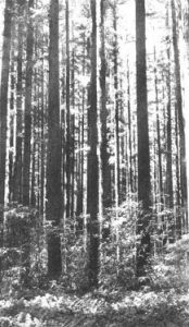
Young Douglas fir in the Bohemia Ranger District, September 1945. Courtesy U.S. Forest Service.
Brice Creek CCC recruits cutting trees. Courtesy U.S. Forest Service.
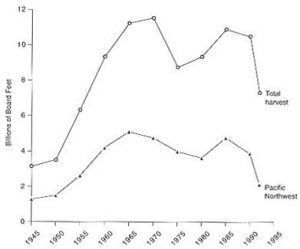
Source: U.S. Forest Service.
Map. Courtesy of the Umpqua National Forest.
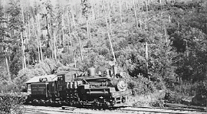
“Two Spot.” Courtesy U.S. Forest Service.
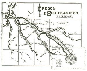
Oregon and Southeastern Railroad map.
Loading a logging truck. Courtesy U.S. Forest Service
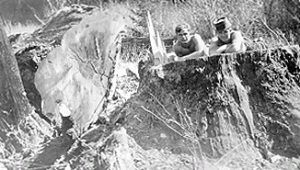
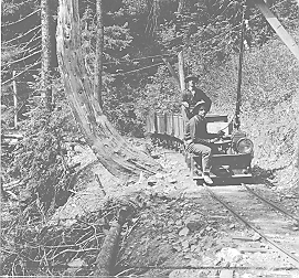
Musick Mine tramway. Courtesy U.S. Forest Service
Loggers use a yarder to stack lumber. Courtesy U.S. Forest Service
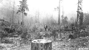
Cut in the Umpqua National Forest, 1914. Courtesy of the Umpqua National Forest
Courtesy U.S. Forest Service.
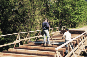
Construction of the trail entailed a multi-agency partnership that included the city of Cottage Grove, Lane County, the state of Oregon, and federal agencies. Courtesy of the Bureau of Land Management.
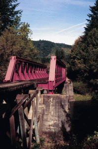
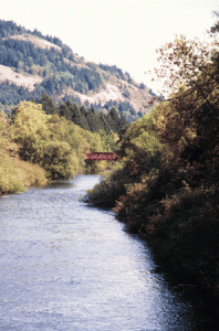
A reminder of the area’s former mining and logging days, this railroad bridge now takes bicyclists and joggers across the Row River.
View of the railroad bridge and the Row River from the 14-mile loop.
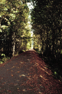
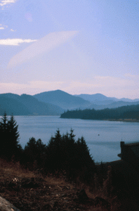
View of Dorena Lake from the trail.
Another view of the lake from the trail.
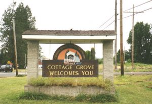
South of Cottage Grove, 1999.
The Cottage Grove Museum. Courtesy of Katy Barber.
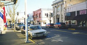
Downtown Cottage Grove in January 2000. Courtesy Katy Barber.
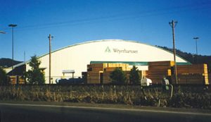
Weyerhaeuser
The Woodard Library. Courtesy Katy Barber.
Promoting the study of Columbia River Basin history