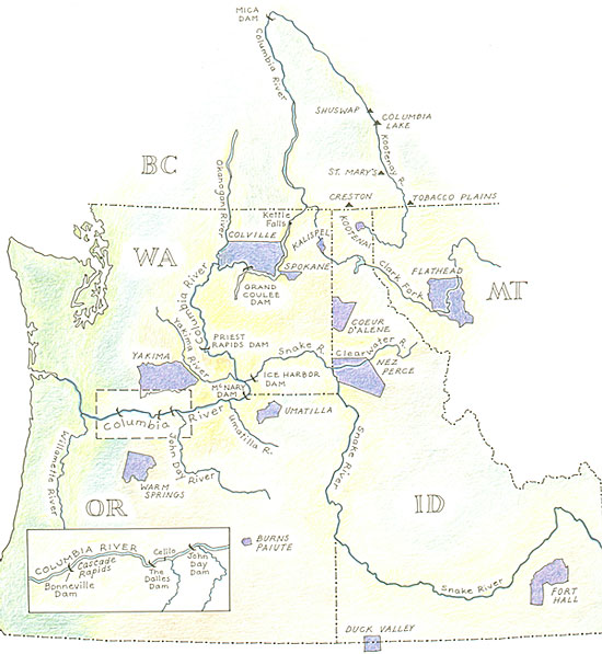
Welcome to the Center for Columbia River History’s Columbia Basin Native Fishery Web site! The map above is an image map. From it you can retrieve profiles of the indigenous groups in the Columbia Basin that were included in the Northwest Power Planning Council Act passed by the U.S. Congress in 1980. This list does not represent all of the indigenous groups of the basin, past or present.
The side navigational bar takes you the documents that provide the foundation for Indian fishing rights such as treaties and court cases in both the U.S. and Canada. Use these documents to answer the “questions to consider.” Other sections address treaty harvest rights, dams and their effects on the native fishery, and traditional fishing methods. Go to the photo archive to see all of the photographs used in this Web site. The table of contents provides a visual map of the entire site. Enjoy your visit!